National Agro Solutions has extensive knowledge of the diverse climate regions of Ethiopia and their impact on crop growth. Our team conducts thorough analysis of various locations to identify the most appropriate crops and to optimize yield and productivity. This approach allows us to make informed decisions that can have a positive impact on crop selection and overall performance.
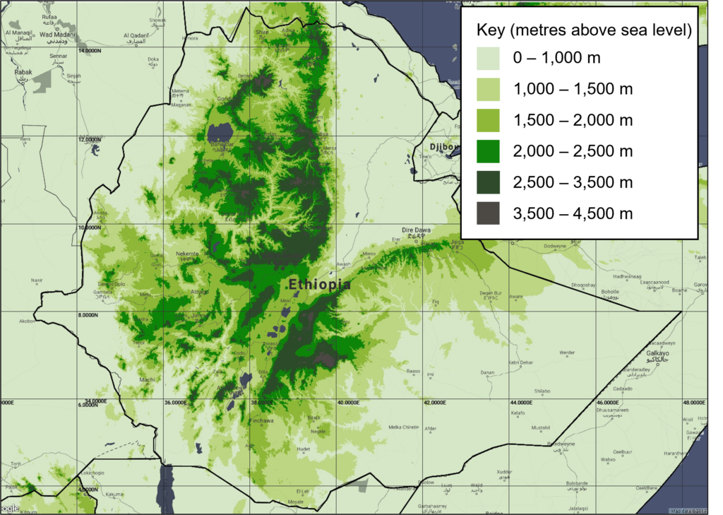
Elevation Profile
- Ethiopia’s topography is diverse, ranging from 20 mountains peaking above 4,000m to one of the lowest points on the Earth’s surface, the Danakil Depression, which lies almost 120m below sea level.
- Two principal geographical zones can be found in the country: the cool highlands and the hot lowlands that surround them. Ethiopia’s main topographical feature is the vast central plateau (the Ethiopian highlands) with an average elevation between 1,800m and 2,400m. It’s here that the country’s major peaks are found including Ras Dashen at 4,543m, Ethiopia’s highest and Africa’s tenth highest mountain.
Exhibit 1: Ethiopia’s elevation profile (masl)
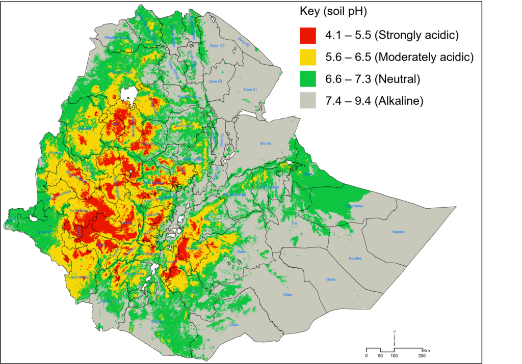
Soil Acidity
- 28% of Ethiopia is covered with acidic soil, 7% is strongly acidic and 21% moderately acidic.
- For example, tea estates in the south west comprise of clay loam soils that are moderately / strongly acidic, with good moisture retention, and highly suitable for tea production.
Exhibit 2: Ethiopia’s soil acidity map (soil pH)
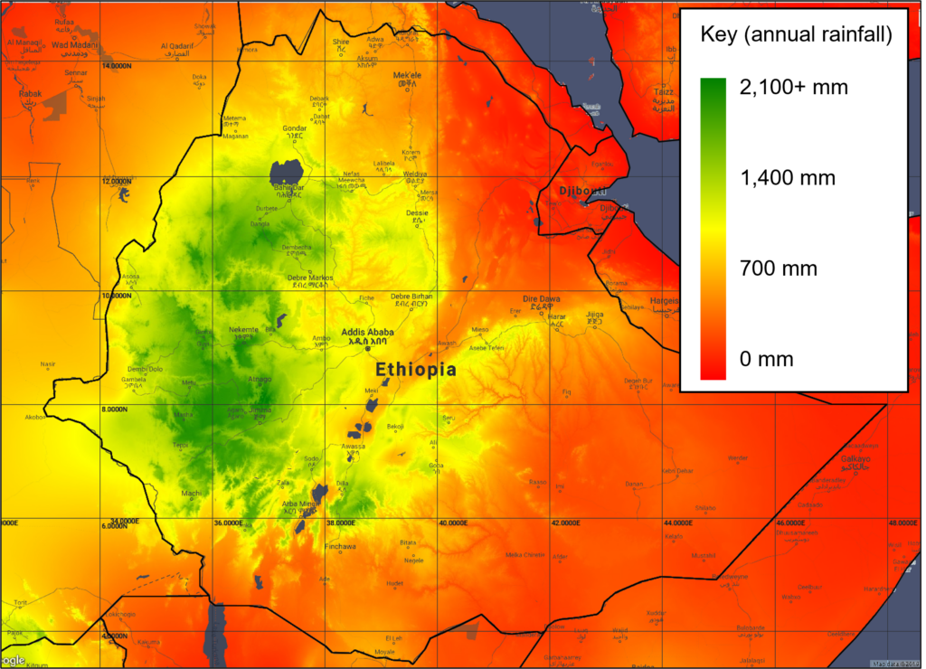
Annual Precipitation
- While Ethiopia has abundant annual rainfall, the rainfall varies spatially, temporally and inter-annually.
- Heavy rainfall occurs in most of the country during June, July, and August. The High Plateau also experiences a second, though much milder, rainy season between December and February.
- 80 percent of rainfall occurs between June and September, while yearly variability can also be significant (e.g., about 30 percent average variation year over year).
Exhibit 3: Ethiopia’s Annual precipitation (mm)
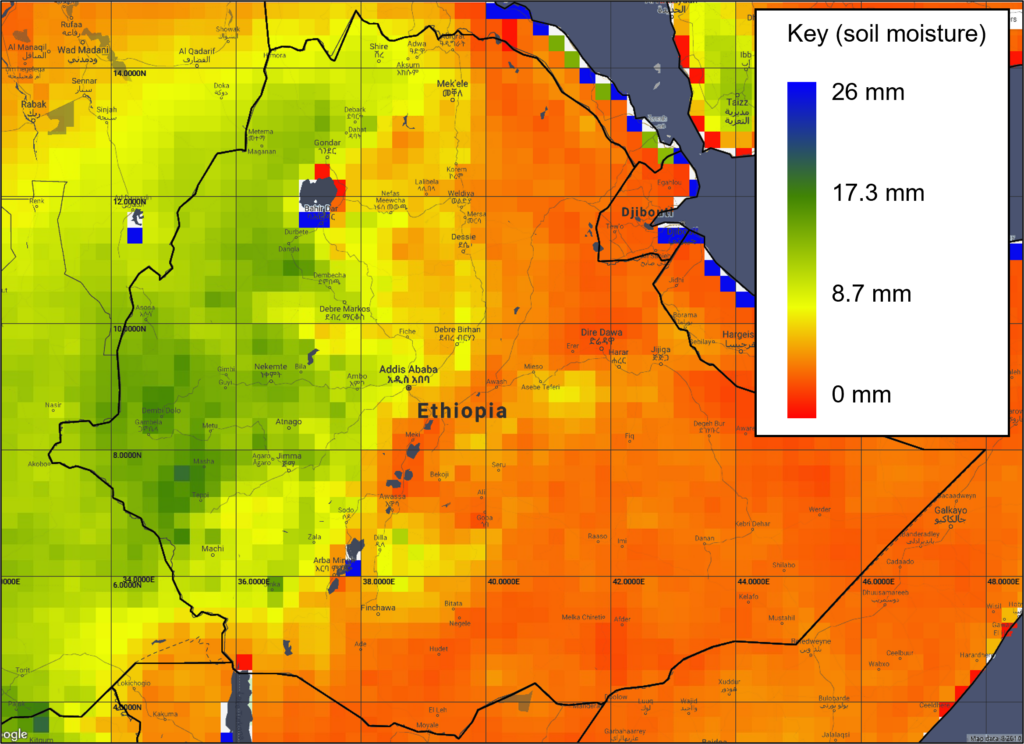
Soil Moisture
- Out of the total land area (111.5millon Ha), about 74.3 million Ha is suitable for crop production.
- Of the estimated arable land, around 18 million Ha is currently cultivated under rain fed crops.
- Ethiopia is 9 degrees north of the Equator, but the high altitude and moderates temperatures result in a year-round mild climate.
Exhibit 4: Ethiopia’s soil moisture (mm)
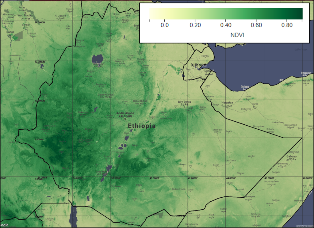
Normalised Difference Vegetation Index (NDVI)
- Ethiopia’s rainfed agricultural area, comprises an area measuring approximately 667,923 km2, covering the Upper Eastern Nile Basin, which contributes more than 86% of the Nile River flow.
Exhibit 5: Ethiopia’s vegetation index map